- Contenidos:
- Coordenadas de Kreisfreie Stadt Landshut
- Distancias a Kreisfreie Stadt Landshut
- Accidentes geográficos
- Ciudades próximas a Kreisfreie Stadt Landshut
Aquí podrás obtener las coordenadas geográficas de Kreisfreie Stadt Landshut, Alemania, de manera sencilla, también te convertirmos las coordenadas en grados decimales para que puedas localidar Kreisfreie Stadt Landshut, Alemania, en Google Maps. La población de Kreisfreie Stadt Landshut es de 65.322 habitantes.
Coordenadas geográficas de Kreisfreie Stadt Landshut, Alemania, en grados decimales:
- Longitud: 12.1641700
- Latitud: 48.5397200
Coordenadas geográficas de Kreisfreie Stadt Landshut, Alemania, en grados y minutos decimales:
- Longitud: E12°9'51.01"
- Latitud: N48°32'22.99"
| Ciudad | Distancia | Coordenadas |
| Kreisfreie Stadt Landshut | 0 Km | N48°32'22.99" E12°9'51.01" |
| Landshut | 1 Km | N48°31'46.6" E12°9'42.44" |
| Landkreis Landshut | 4 Km | N48°34'14.02" E12°10'50.02" |
| Dingolfing | 27 Km | N48°38'32.78" E12°29'34.19" |
| Landkreis Erding | 29 Km | N48°18'19.01" E12°0'22" |
| Erding | 32 Km | N48°18'21.71" E11°54'24.7" |
| Landkreis Freising | 33 Km | N48°26'26.99" E11°44'6" |
| Frisinga | 34 Km | N48°24'12.64" E11°44'55.54" |
| Landkreis Dingolfing-Landau | 35 Km | N48°39'1.01" E12°36'33.98" |
| Landkreis Kelheim | 39 Km | N48°50'25.01" E11°53'53.02" |
| Landkreis Mühldorf am Inn | 39 Km | N48°13'49.01" E12°24'46.01" |
| Mühldorf | 42 Km | N48°14'48.12" E12°31'17.58" |
| Landkreis Pfaffenhofen an der Ilm | 47 Km | N48°34'53" E11°32'4.99" |
| Kelheim | 47 Km | N48°55'2.1" E11°53'10.25" |
| Landkreis Straubing-Bogen | 47 Km | N48°50'30.73" E12°36'40.75" |
| Straubing | 48 Km | N48°52'52.54" E12°34'25.86" |
| Kreisfreie Stadt Straubing | 49 Km | N48°53'11" E12°35'3.98" |
| Altötting | 52 Km | N48°13'31.19" E12°40'35.94" |
| Landkreis Rottal-Inn | 52 Km | N48°26'51" E12°50'58.99" |
| Kreisfreie Stadt Regensburg | 53 Km | N49°0'47.34" E12°6'42.84" |
| Ebersberg | 53 Km | N48°4'37.56" E11°58'14.27" |
| Landkreis Ebersberg | 54 Km | N48°4'52" E11°54'51.98" |
| Ratisbona | 55 Km | N49°2'4.24" E12°7'9.23" |
| Landkreis Altötting | 55 Km | N48°12'41" E12°43'37.99" |
| Landkreis Regensburg | 57 Km | N49°3'7.74" E12°4'46.85" |
| Pfarrkirchen | 58 Km | N48°25'55.38" E12°56'17.23" |
| Ingolstadt | 60 Km | N48°45'54.29" E11°25'25.39" |
| Kreisfreie Stadt Ingolstadt | 61 Km | N48°45'37.01" E11°24'32" |
| Dachau | 62 Km | N48°15'36" E11°26'2.47" |
| Múnich | 62 Km | N48°8'14.75" E11°34'31.76" |
| Ciudad | Distancia | Coordenadas |
| Erlberg-Kopf | 86 Km | N47°46'40.51" E12°22'33.85" |
| Biber-Revier | 95 Km | N49°12'1.73" E12°59'37.07" |
| Stollenberg | 124 Km | N49°32'46.25" E11°25'5.16" |
| Spitzelberg | 125 Km | N49°33'35.96" E11°27'3.02" |
| Bolusberg | 166 Km | N48°35'45.78" E9°54'37.12" |

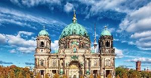
Dónde ir en Alemania para un fin de semana
Pero un fin de semana puede no ser suficiente para descubrir todas las riquezas y diversidades de este país europeo. Tierra de contrastes, le ofrecerá sus inmensos bosques y verdes colinas, sus noches festivas, su rico patrimonio cultural, sus museos, sus castillos, su historia y sus ciudades tan encantadoras como auténticas. Los viajes a Alemania...

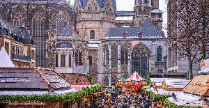
Curiosidades de Aquisgrán
Aquisgrán (Aachen) es una antigua ciudad imperial en el corazón de Europa. Curiosidades de Aquisgrán Un topónimo vinculado al agua. Los romanos habitaron en este lugar por sus aguas termales, con temperaturas de hasta 74° C. Lo llamaron "Aquae Granni", que significa "las aguas termales del dios curativo celta Grannos". Este topónimo latino...

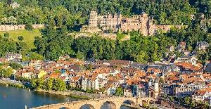
Baden-Württemberg
Por un lado, la riqueza económica, como el dinámico Stuttgart, pero también un hermoso patrimonio histórico y natural, suficiente para atraer la atención de viajeros curiosos, seguidores de los paisajes romántico, balnearios, castillos, viñedos, lagos, todo a un paso de Francia: Baden-Württemberg limita con Alsacia. Lo más destacado de...
- Kreisfreie Stadt Landshut
- Landshut
- Landkreis Landshut
- Dingolfing
- Landkreis Erding
- Erding
- Landkreis Freising
- Frisinga
- Landkreis Dingolfing-Landau
- Landkreis Kelheim
- Landkreis Mühldorf am Inn
- Mühldorf
- Landkreis Pfaffenhofen an der Ilm
- Kelheim
- Landkreis Straubing-Bogen
- Straubing
- Kreisfreie Stadt Straubing
- Altötting
- Landkreis Rottal-Inn
- Kreisfreie Stadt Regensburg
- Ebersberg
- Landkreis Ebersberg
- Ratisbona
- Landkreis Altötting
- Regensburg
- Pfarrkirchen
- Ingolstadt
- Kreisfreie Stadt Ingolstadt
- Dachau
- Múnich
- Te puede interesar:
- Antípodas de Kreisfreie Stadt Landshut
- Coordenadas de Alemania


